
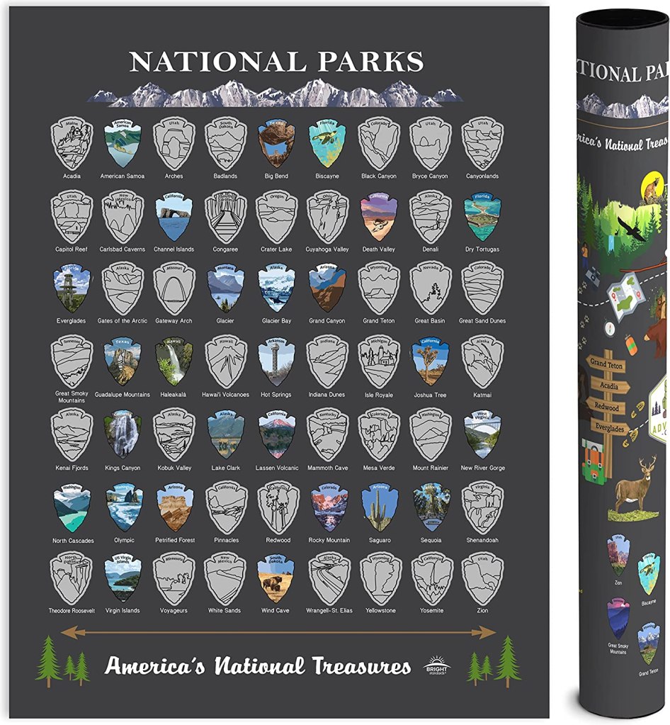
As a family, we have set a goal to visit all the National Parks by the time our oldest is 18. To keep track of the parks we have visited, we got a National Park scratch-off map, like the one linked to the left. It is fun for our kids to see where they have been and where we still need to go.
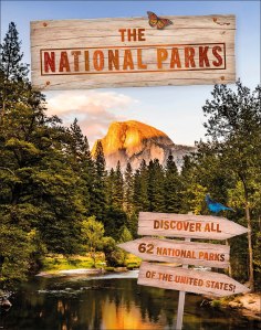
We are featuring some of our family’s favorite National Parks that are rich in Geology. To learn more about our National Parks, check out two of our favorite books (linked below): Complete National Parks of the United States and The National Parks.
The Complete National Parks of The United States is the ultimate guide for all things National Parks including trail maps and top-rated activities. The National Parks is a favorite of our younger kiddos and includes beautiful photos, illustrations, and fun facts!

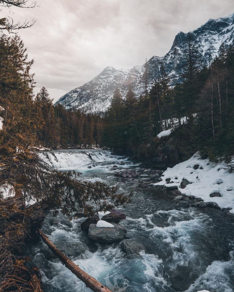
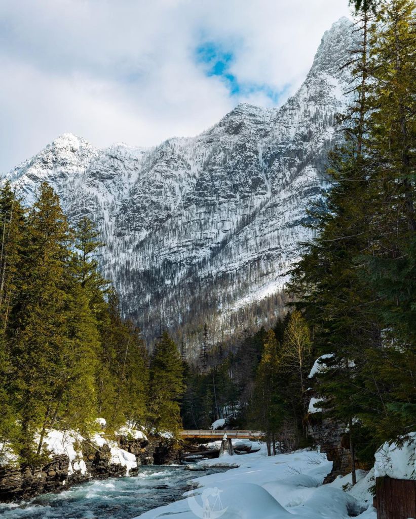
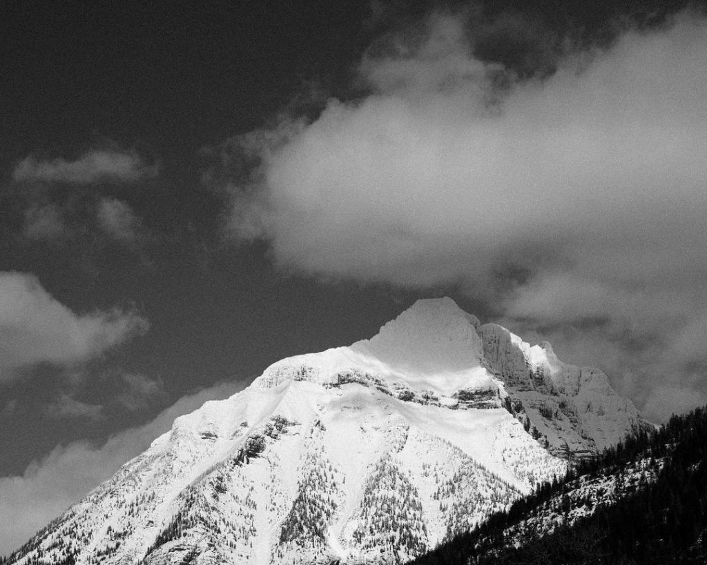
Glacier National Park
In Glacier National Park, spectacular views of rocks from the Precambrian Belt Supergroup are abound! The Precambrian Belt Supergroup is comprised of fine-grained sedimentary rocks that were formed 1.6- to 800-million years ago. Here you can find the Earth’s history preserved in the sedimentary rocks; in ripples, mud cracks, and ancient fossils of blue-green algae. The story these rocks tell is one of an ancient, alien landscape, void of terrestrial life, where massive sheet floods swept across whole continents.


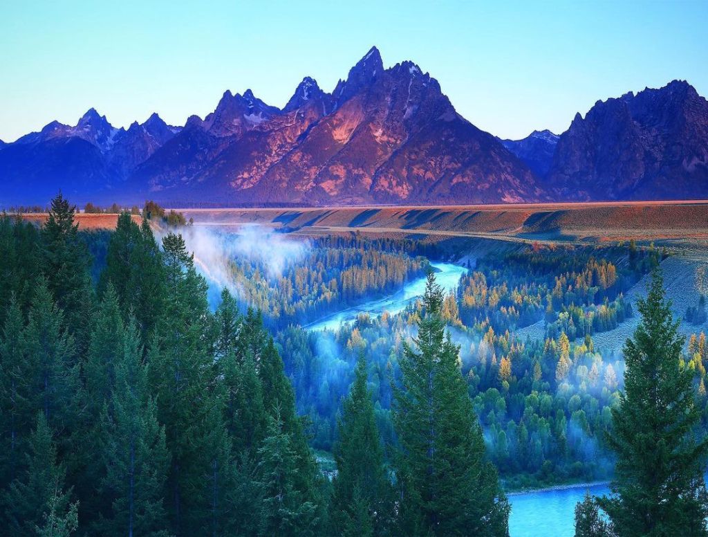
Grand Teton National Park photos courtesy of NocturnImagery
Teton National Park
The Teton Range is one of the most breath-taking mountain ranges in North America. Here on display, is the battle between the tectonic forces that form mountains, and the erosional forces that slowly wear them down. This battle is evident in the jagged peaks rising above the piles of rock below. And the mountains continue to grow! Tectonic forces continue to lift the Teton Range, while at the same time, Jackson Hole to the east continues to sink.

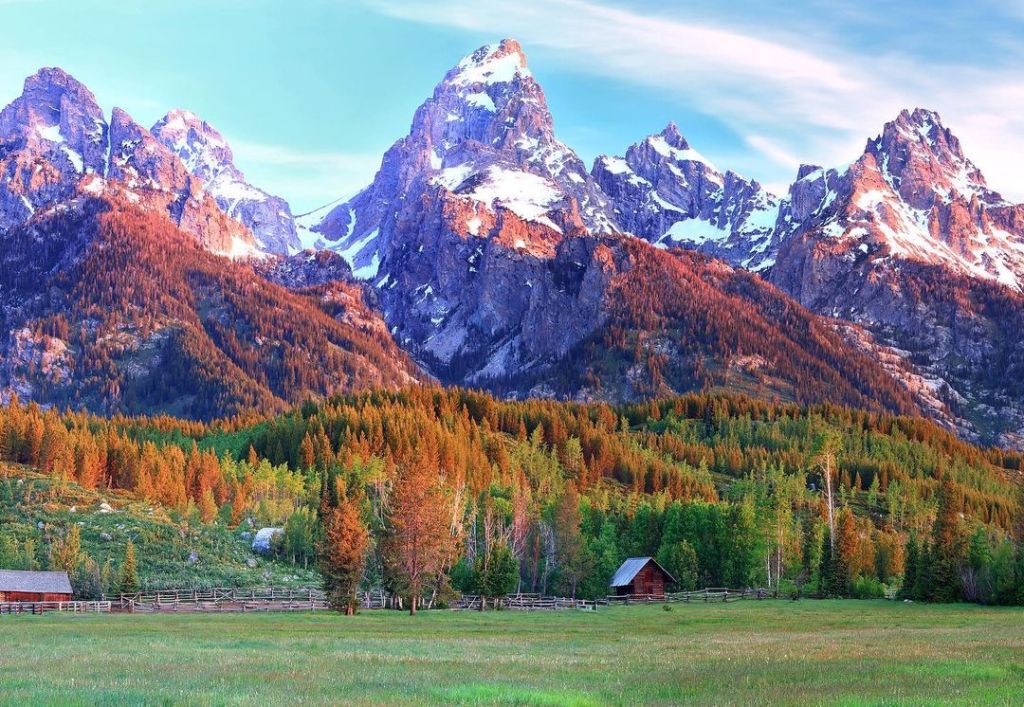
Teton National Park photos curteousy of Jeffrey Murray Photography
North Cascade National Park
The North Cascades is one of the most complex geologic setting in the North America. Over 400 million years ago, ancient islands were slowly carried by moving oceanic plates and smashed against the continental landmass. The rock masses were thrusted upwards into a jumbled array of mountains. These ancient mountains were faulted and eroded to nearly a level plain. However, the dense oceanic crust continued to sink (subduction) beneath the continental crust. The subducting material melted and some of the melt rose towards the surface in explosive volcanic fashion, the rest recrystallized forming large bodies of granitic rock that represent the core of the present North Cascades terrane. Tectonic forces pushed these rock masses upwards, exposing this complex geology. The landscape continues to be formed by volcanism and erosional forces.

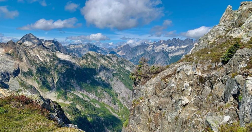

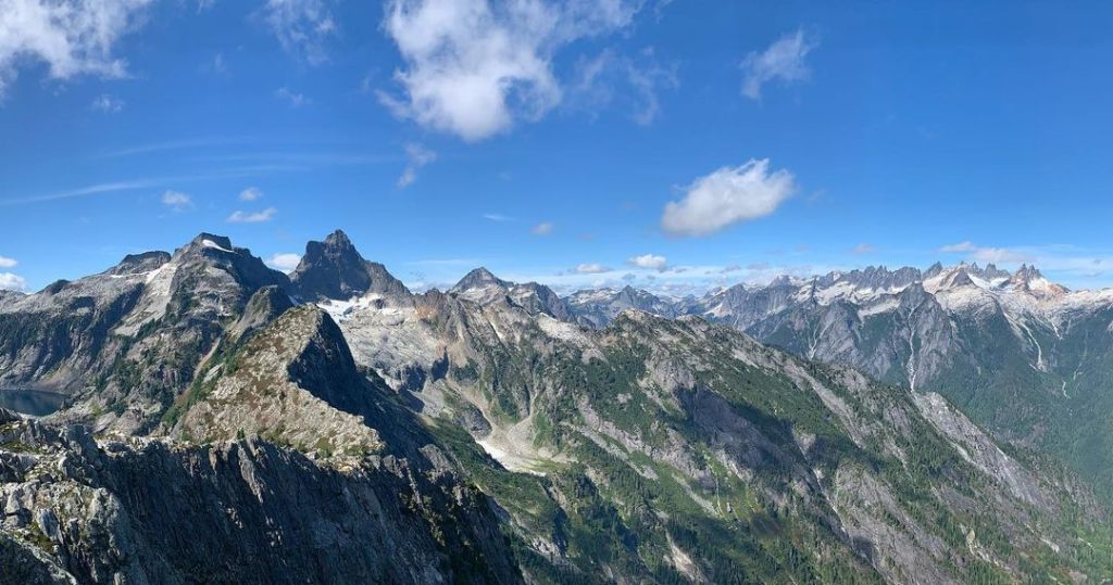
North Cascade National Park photos curteousy of Nick Kendell
Yellowstone National Park
Yellowstone National Park is one of the most dynamic geologic features in the world and is the location of one of the largest volcanic eruptions to have occurred! Yellowstone National Park sits atop of a large body of magma or molten rock. Water heated by this magma escapes through the many hot springs, geysers, and other geothermal features in the park and surrounding area. Although another eruption is unlikely in the foreseeable feature, scientists closely monitor volcanic activity at the park. This monitoring detects thousands of earthquakes in the park every year within the park’s seismograph stations, as well as closely measures vertical and horizontal ground movements to within a centimeter using very precise GPS and satellite radar imagery.

Yellowstone National Park photos curteousy of Julie Love
Yosemite National Park
Yosemite National Park is known for its incredible rock exposures. Most of the rocks in Yosemite are granitic rock, although some metamorphic and volcanic rocks are also present. Granitic rock is a general term to describe plutonic igneous rocks, or rocks that formed from magma beneath Earth’s surface, such as granite, granodiorite, tonalite, quartz monzonite, and quartz monzodiorite. The plutonic rocks in Yosemite formed over 100 million years ago. Tectonic forces uplifted these rocks and the processes of erosion have shaped the landscape into what we see today, most significantly being glacial erosion and deposition that began about 2 to 3 million years ago.
Most of the rocks in Yosemite National Park are plutonic igneous rocks, or rocks that formed from magma beneath Earth’s surface, that include granite, granodiorite, tonalite, quartz monzonite, and quartz monzodiorite. These rocks formed over 65 million years ago. Tectonic forces lifted these rocks to more than 13,000 feet above sea level
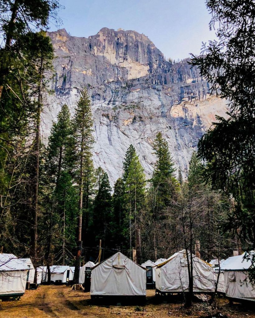

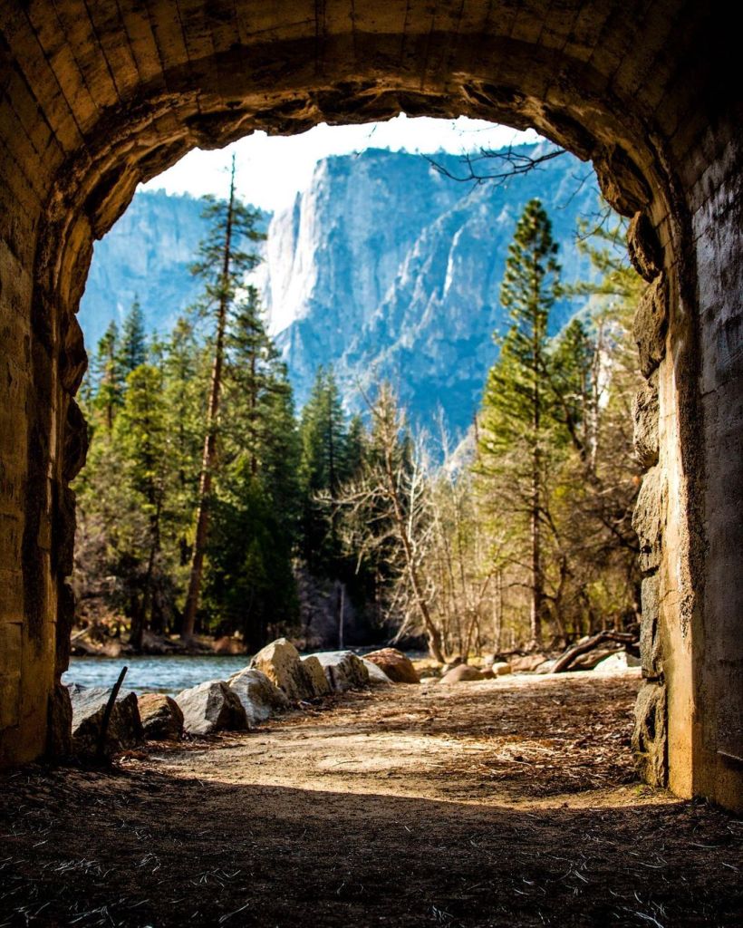
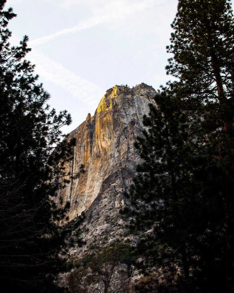
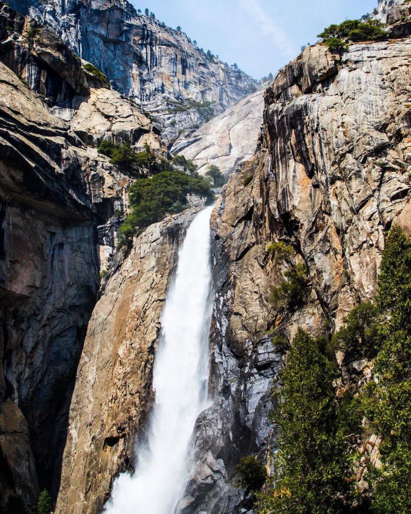
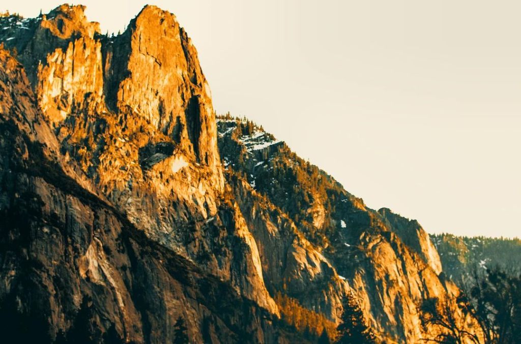


Yosemite National Park photos courtesy of Cypercoastvisuals
Grand Canyon National Park
The Colorado River has been carving out the Grand Canyon for the past five to six million years. Equally impressive as the views, the distinct layers of the Grand Canyon tell the story or our ancient world. Starting at the bottom are metamorphic rock, with igneous intrusions that tell the very story of when North America was created, a story of volcanic islands colliding with a continental landmass. The rocks overlaying these, the Grand Canyon Supergroup, consist of sedimentary rocks deposited at a time when the world was void of complex lifeforms. Above the Grand Canyon Supergroup lies much younger sedimentary rock that are rich in fossils and make up most of the reddish rocks you see in the canyon’s breathtaking views. One thing you might notice, rock layers of the Grand Canyon Supergroup have been tilted, while the rocks above are horizontal. This is referred to as an angular unconformity and represents a gap in the geological history, where rock has been eroded away, and over time, new layers were formed.


Grand Canyon National Park photos courtesy of Johnny Adolphson Photography
Mammoth Cave National Park
Mammoth Cave National Park is home of the longest cave system on Earth. More than 400 miles of passageways have been mapped; however, explorers have yet to find the end to it! This unique cave system is due to the limestone rock that formed from millions of years ago. The minerals in limestone are susceptible to dissolution by acidic groundwater. As rainwater percolates through the soil, it picks up carbon dioxide and becomes slightly acidic. Over time, this reaction formed the channels and passageways we explore today. Stalagmites and stalactites are some of the best-known cave formations and a favorite for visitors. How do you remember the difference? Try this: Stalagmites push up with all there might! Stalactites hang tight to the ceiling!
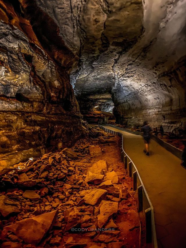

Mammoth Cave National Park photo courtesy of Cody Pate
Mount Rainer National Park
Mount Rainer is a magnificent mountain that towers over the Seattle Tacoma metropolitan area and is the highest volcano in the Cascade Range standing at over 14,000 feet. This active stratovolcano is a textbook example of volcanism that occurs when two tectonic plates collide, resulting in the denser oceanic crust sinking beneath the continental plate. This type of interaction is known as a subduction zone, and in the area of Mount Rainer the denser oceanic plate known as the Juan de Fuca Plate subducts beneath the continental North American Plate. The Juan de Fuca Plate dives deep beneath Earth’s surface. Increasing temperatures and pressures start to melt the plate and the less dense material from the melt will rise towards the surface, potentially making it to the surface in explosive fashion!


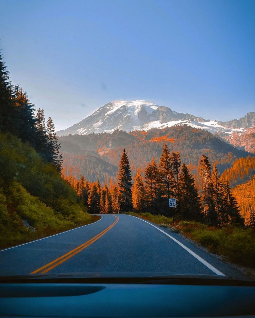
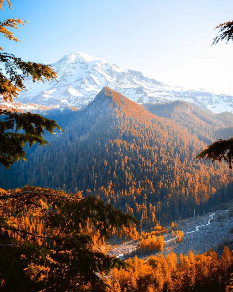


Mount Rainer National Park photos courtesy of Ryan Little
Great Smoky Mountain
National Park
The Great Smoky Mountains are remnants of an ancient mountain range that were once similar in elevation to today’s Rockies. The mountains formed when the North American tectonic plate collided with the African tectonic plate, forming the supercontinent know as Pangaea. As the plates collided, the once horizontal layers of the sedimentary rocks present in the area where folded and broken by faults. Following uplift, and the breakup of the supercontinent of Pangaea, the newly formed mountains were further shaped by intense erosion. Erosion continues to shape the landscape. The mountains continue to gradually erode at a rate of about two inches every thousand years. Where do they go? Eventually, carried down the Mississippi River and into the Gulf of Mexico, including the gulf’s beautiful beaches!
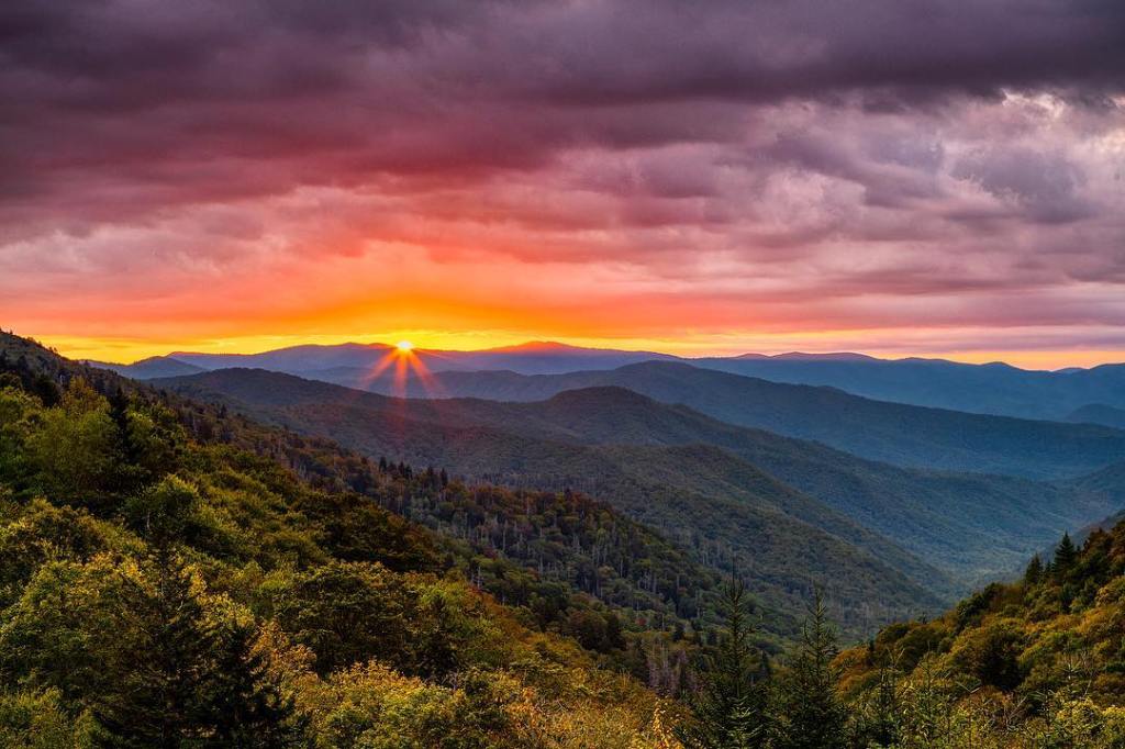


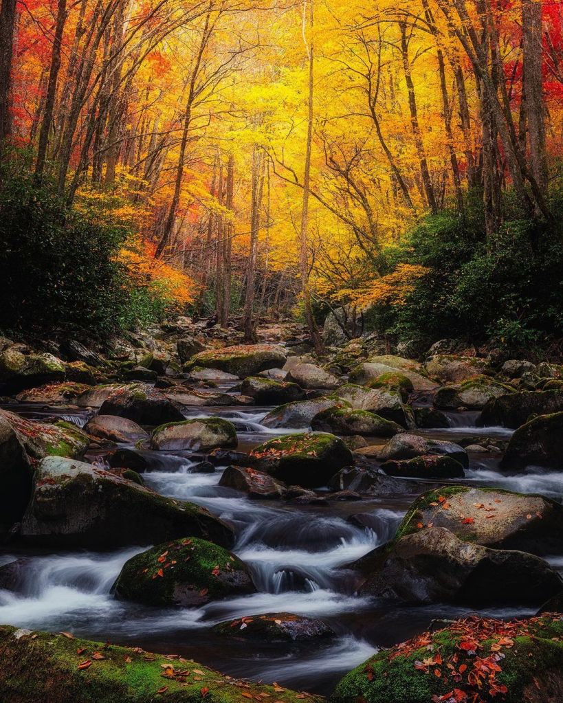

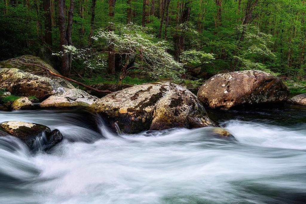
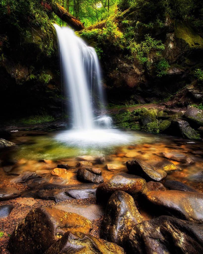
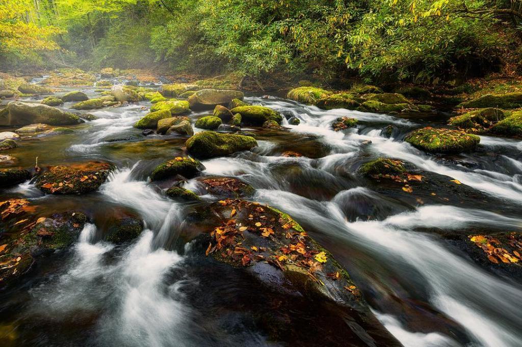
Great Smokey Mountain National Park photos courtesy of Luke Sutton Photo
